GIS Details
A geographic information system (GIS) is a framework for gathering, managing, and analyzing location data. Rooted in the science of geography, GIS integrates many types of data. It analyzes spatial location and organizes layers of information into visualizations using maps and 3D scenes. Learn more gis
GIS details
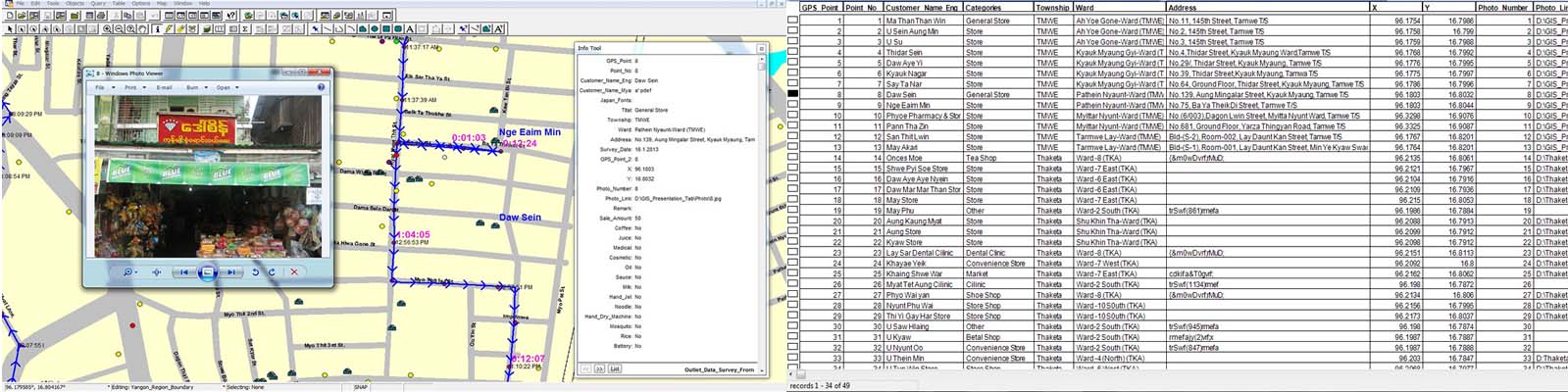
We at DPS have been involved in Map making and data warehousing with Geographical Information System (GIS) from day one. Our first project is to acquire Satellite Maps in 1998 (that time satellite maps are reversed for military and oil and gas exploration only in Burma). Then we set up Ground Control Points using Trimble Pro XR survey GPS. We have completed Yangon Streets in UTM in 1998. At that time our major customer includes US Government, MEGA Life Sciences. Now our GIS Data includes the whole Myanmar Road Network, Villages Points, Address Points (AP) and Points of Interest (POI). APs are mainly used by Ride Hailing Applications and Navigation such as Grab Taxi and Tom Tom. DPS has some 300,000 APs for Yangon and Mandalay and other major cities. POIs are used by City Guide Maps, Ride Hailing and Distribution companies (Retail Outlets). DPS has 60,000 POI with rich attributes for Distribution and Retail companies as well as Bank/Insurance application. DPS Future rely on its expertise to collect rich attribute data for future use of Retail, Navigation and Autonomous Vehicles.
The Benefits of using Drone Aerial Photo when printing map. tab to view.
- Up to date Aerial photo of your property.
- Digital Elevation Model (DEM) is available.
- Contour Maps are available to know altitude map.
- You can find out about the number of plants growing on your property or the nature of the plants and the conditon of the plants.
- The right decision can be made for the construction of drainage pipes and the drainage of pipelines in their own land.
- The low altitude and flood situation can be seen clearly, so it can make the right decisions for residential and other important building.
Export tempor illum tamen malis malis eram quae irure esse labore quem cillum quid cillum eram malis quorum velit fore eram velit sunt aliqua noster fugiat irure amet legam anim culpa.
Project information
- Category GIS
- Client Dpsmap
- Project date 01 March, 2020
- Project URL www.dpsmap.com
- Visit Website
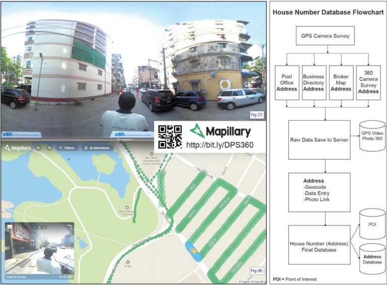
Step by Step Demonstration of How to List House Number Data
Shop Data and Retail Outlet
Counting High Condo
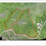
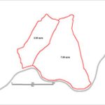
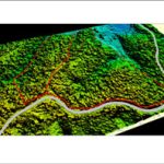
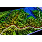
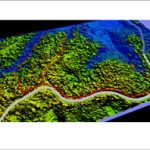
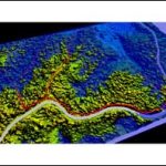
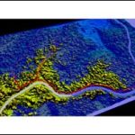
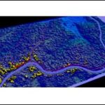
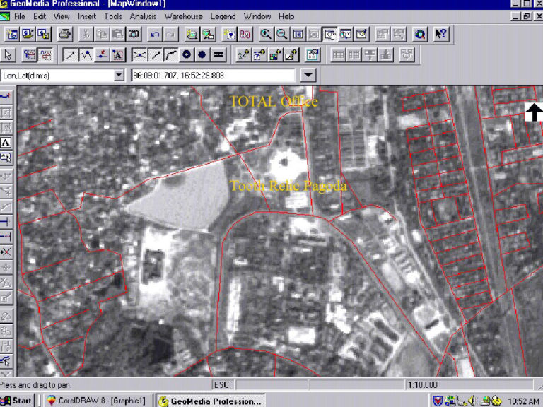
Update Aerial Photo taken with Drone Farm Land and Land,how to get a site plan image by using Drone?
Own property, land and land Aerial Photo Terrain Digital Elevation Model (DEM) Contour maps, If you want to create a site plan, you can use high quality aerial photos by Drone to produce high quality site maps and compute site plans. It also calculates currents and floods in the Site Plan Area; Where should the Site Plan Area be built? How should a drain be constructed? How should plants be planted? Data is available about the altitude, topography, etc.
Sample photo take by Drone and print out by aerial photo.

Mergui Archipelago Island Finder
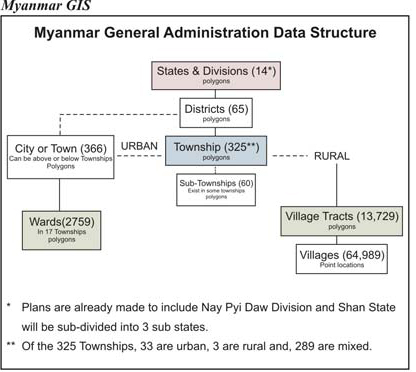
Myanmar GIS
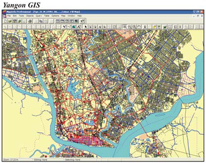
Yangon GIS
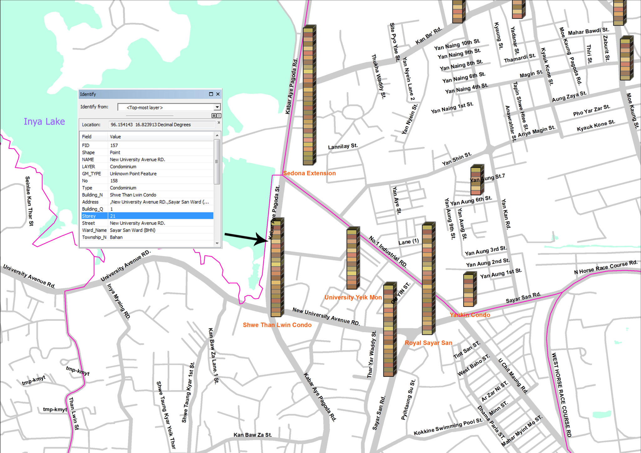
Yangon City Digital Map
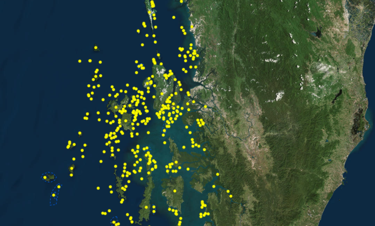
Mergui
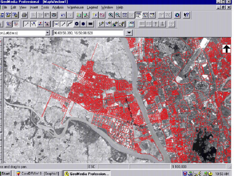
The Yangon City Digital Map is a Geographic Information System (GIS) using Intergraph’s Geomedia Professional software. Base map is digitized from Satellite Imagery – IRS Panchromatic at 5.8 meter resolution. It was calibrated with Trimble’s Pro XR GPS for on ground reference.
- Street map
- Street names
- Landmarks / Places (Moderated by DPS)
- Lanmadaw
- Kyauktada
- Pabedan
- Latha
- Botahtaung
- Pazundaung
- Dagon Seikkan
- Kyeemyindaing
- Ahlone
- Bahan
- Sanchaung
- Mingalar
- Taungnyunt
- Tarmwe
- Kamayut
- Yankin
- Kyeemyindaing
- Hlaing
- South Okkalapa
- North Okkalapa
- Mayangone
- Insein
- Thaketa
- Dawbon
- Dagon Seikkan
- South Dagon
- North Dagon
- East Dagon
- Shwe Paukkan
- Mingalardon
- Hlaing Tharyar
- Shwe Pyithar
- Dala
360 Photos
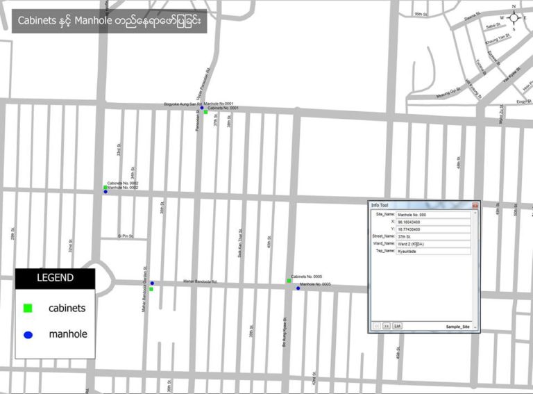
Services for Fiber Optic Cable
- Fiber Services need to design the network of fiber to be laid out before actual ground work. GIS is essential to estimate the length, allocation of work, location of trails to dig and avoid the obstacles.
- Can store database in GIS Map, for example man-holes and hand-holes, junction boxes, cabinets or what kind of fiber cable used.
- According to the stored database, you can also know the end date of the fiber line and easily maintain if it is damaged.
#Why should use GIS MAP?
-2021 updated data extends to Yangon Region Boundaries.
-Address Database with House numbers guaranteed to exceed any available onpne data.
-Village Tracts
-Villages
-Township Boundary
-Towns
-Industrial Zones
-Points of Interest – POI Layer
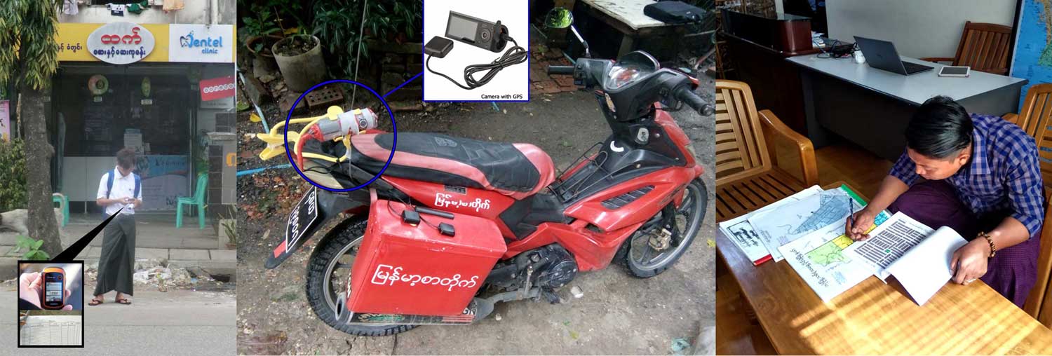
For home number (database), the GPS camera have to be installed in motorbikes and bicycles to carry out the survey. In front of every home, the GPS points and photos have to be taken along with collecting the details.